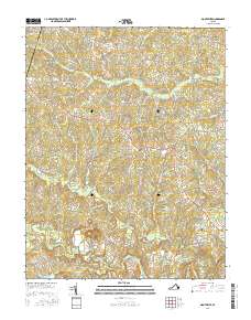
2016 Map of Montpelier
USGS Topo · Published 2016About this map
Montpelier and the surrounding central Virginia landscape are defined by a complex web of tributaries feeding into the South Anna River and the Newfound River. This 2016 survey illustrates the persistent rural settlement pattern of Hanover County, where communities like Gouldin, Mabelton, and Goodall anchor a network of family-named roads and farm tracts. The terrain is notably wet, marked by Wolf Swamp, Jones Swamp, and Cattail Cr, which influence the winding paths of local routes such as Mabelton Rd and Old Ridge Rd.
Find a feature on this map
125 named features on this map. Tap any name to fly to it.
Don’t see what you’re looking for? This feature index may not catch every label — zoom into the map to look around manually.
Map Details
Editions of this 2016 Montpelier Map
This is the sole edition of this map. No revisions or reprints were ever made.
Other maps of this area

1890 · Goochland
USGS Topo · 1:125,000

1892 · Goochland
USGS Topo · 1:125,000

1936 · Glen Allen
USGS Topo · 1:24,000

1941 · Glen Allen
USGS Topo · 1:31,680

1942 · Buckner
USGS Topo · 1:24,000

1942 · Beaverdam
USGS Topo · 1:24,000

1943 · Mabelton
USGS Topo · 1:31,680
1943 · Hanover Academy
USGS Topo · 1:31,680

1943 · Perkinsville
USGS Topo · 1:31,680
1943 · Buckner
USGS Topo · 1:31,680