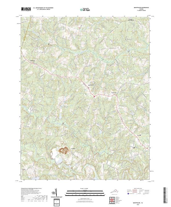
2022 Map of Montpelier
USGS Topo · Published 2022About this map
Montpelier serves as the central hub of this landscape, situated near the intersection of several local routes such as Mountain Rd and Bethany Church Rd. The region is defined by a dense network of watercourses, with the South Anna River flowing through the southern portion while the Newfound River and Cattail Cr drainage systems carve the northern terrain. This survey captures a mix of established crossroads and rural family-named landmarks, highlighting a settlement pattern typical of Piedmont Virginia where small communities like Gouldin, Goodall, and Mabelton are connected by historically significant corridors. Genealogists can identify key local landmarks including the Saint Peters Cem and the Po at Montpelier, which anchor the social geography of the era. The mapping of Needstan Cr and Jones Swamp further illustrates the low-lying wetlands that influenced local road placement and land use across this part of Hanover County.
Find a feature on this map
114 named features on this map. Tap any name to fly to it.
Don’t see what you’re looking for? This feature index may not catch every label — zoom into the map to look around manually.
Map Details
Editions of this 2022 Montpelier Map
This is the sole edition of this map. No revisions or reprints were ever made.
Other maps of this area

1890 · Goochland
USGS Topo · 1:125,000

1892 · Goochland
USGS Topo · 1:125,000

1936 · Glen Allen
USGS Topo · 1:24,000

1941 · Glen Allen
USGS Topo · 1:31,680

1942 · Buckner
USGS Topo · 1:24,000

1942 · Beaverdam
USGS Topo · 1:24,000

1943 · Mabelton
USGS Topo · 1:31,680
1943 · Hanover Academy
USGS Topo · 1:31,680

1943 · Perkinsville
USGS Topo · 1:31,680
1943 · Buckner
USGS Topo · 1:31,680