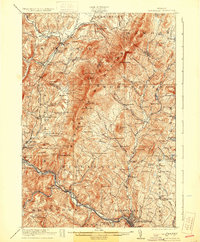
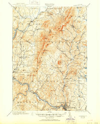
1921 Map of Montpelier
USGS Topo · Published 1931About this map
The Winooski River and the Central Vermont Railway corridor anchor this 1919 survey, illustrating the transportation spine of central Vermont. The state capital, Montpelier, is detailed alongside neighboring industrial and agricultural hubs like Waterbury and Stowe. The map reveals a dense network of early 20th-century rural infrastructure, including a proliferation of numbered district schools such as No 8 School and No 10 School, alongside localized industry like the Talc Mine near Waterbury.
Find a feature on this map
119 named features on this map. Tap any name to fly to it.
Don’t see what you’re looking for? This feature index may not catch every label — zoom into the map to look around manually.
Map Details
Editions of this 1921 Montpelier Map
6 editions found
Other maps of this area

1919 · Lincoln Mountain
USGS Topo · 1:62,500

1919 · Montpelier
USGS Topo · 1:62,500

1920 · Lincoln Mountain
USGS Topo · 1:48,000

1921 · Richmond
USGS Topo · 1:48,000

1921 · Lincoln Mountain
USGS Topo · 1:62,500

1921 · Montpelier
USGS Topo · 1:62,500

1922 · Barre
USGS Topo · 1:48,000

1924 · Barre
USGS Topo · 1:62,500

1924 · Camels Hump
USGS Topo · 1:62,500

1925 · Mount Mansfield
USGS Topo · 1:48,000