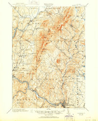
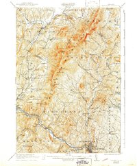
1921 Map of Montpelier
USGS Topo · Published 1951About this map
The Worcester Mountains dominate this 1919 survey, forming a high spine between the Waterbury River and the North Branch of the Winooski River. In the valley floors, a dense network of district schools like the Pucker Street School, Hampshire Hill School, and Kneeland Flat School reveals the dispersed rural population of the early twentieth century. Settlement centers range from the capital at Montpelier to smaller crossroads like Adamant and Sodom.
Find a feature on this map
127 named features on this map. Tap any name to fly to it.
Don’t see what you’re looking for? This feature index may not catch every label — zoom into the map to look around manually.
Map Details
Editions of this 1921 Montpelier Map
6 editions found
Other maps of this area

1919 · Lincoln Mountain
USGS Topo · 1:62,500

1919 · Montpelier
USGS Topo · 1:62,500

1920 · Lincoln Mountain
USGS Topo · 1:48,000

1921 · Richmond
USGS Topo · 1:48,000

1921 · Lincoln Mountain
USGS Topo · 1:62,500

1921 · Montpelier
USGS Topo · 1:62,500

1922 · Barre
USGS Topo · 1:48,000

1924 · Barre
USGS Topo · 1:62,500

1924 · Camels Hump
USGS Topo · 1:62,500

1925 · Mount Mansfield
USGS Topo · 1:48,000