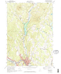
1968 Map of Montpelier
USGS Topo · Published 1973About this map
The North Branch of the Winooski River carves a central valley through this late 1960s terrain, dominated by the capital city and its surrounding hill towns. In Montpelier, the street grid is clearly defined, featuring the State Capitol, Montpelier Vermont College, and the sprawling grounds of Green Mount Cemetery. The infrastructure of the era is evident in the Central Vermont railroad lines and the presence of the Wrightsville Dam, which regulates the river just north of the city center. Outlying hamlets like Adamant and Putnamville reflect the rural character of Washington County, while several family-named cemeteries and The Old Meetinghouse Ch in East Montpelier Center offer significant points of interest for local historians and genealogists. The map also captures the varied landscape from Robinson Hill to several named ponds, including Horn of the Moon Pond.
Find a feature on this map
61 named features on this map. Tap any name to fly to it.
Don’t see what you’re looking for? This feature index may not catch every label — zoom into the map to look around manually.
Map Details
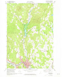
Editions of this 1968 Montpelier Map
2 editions found
Other maps of this area

1919 · Montpelier
USGS Topo · 1:62,500

1921 · Montpelier
USGS Topo · 1:62,500

1922 · Barre
USGS Topo · 1:48,000

1924 · Barre
USGS Topo · 1:62,500

1939 · Plainfield
USGS Topo · 1:48,000

1940 · Plainfield
USGS Topo · 1:62,500

1943 · Plainfield
USGS Topo · 1:62,500

1944 · Montpelier
USGS Topo · 1:62,500

1947 · Corinth
USGS Topo · 1:62,500

1948 · East Barre
USGS Topo · 1:62,500