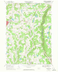
1968 Map of Montrose East
USGS Topo · Published 1971About this map
Montrose serves as the western focal point of this Susquehanna County landscape, where the local economy and geography are defined by a dense network of water bodies and extractive industries. Numerous Quarry and Quarries sites are scattered across the townships of Bridgewater, Franklin, and Harford, illustrating the area's geological utility. The eastern corridor is dominated by the Erie-Lackawanna Railroad, which follows the path of Martins Creek through the settlement of Kingsley.
Find a feature on this map
62 named features on this map. Tap any name to fly to it.
Don’t see what you’re looking for? This feature index may not catch every label — zoom into the map to look around manually.
Map Details
Editions of this 1968 Montrose East Map
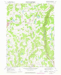
2 editions found
Other maps of this area

1892 · Dundaff
USGS Topo · 1:62,500

1932 · Susquehanna
USGS Topo · 1:62,500

1935 · Susquehanna
USGS Topo · 1:62,500

1943 · Montrose
USGS Topo · 1:62,500

1945 · Montrose
USGS Topo · 1:62,500

1946 · Tunkhannock
USGS Topo · 1:62,500

1946 · Springville
USGS Topo · 1:24,000

1946 · Hop Bottom
USGS Topo · 1:24,000
1946 · Lenoxville
USGS Topo · 1:24,000

1947 · Hopbottom
USGS Topo · 1:24,000