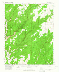
1957 Map of Monument Canyon
USGS Topo · Published 1964About this map
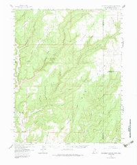
Ancestral sites and remote canyonlands dominate this high desert landscape along the border of Utah and Colorado. The map reveals a high concentration of archaeology, with numerous Cliff Dwellings, Petroglyphs, and Ruins scattered across the complex drainages of Monument Canyon and Lake Canyon. These ancient sites are interspersed with early 20th-century ranching developments, such as Daltons Ranch and family-named infrastructure like the Max Dalton Artesian Well and Bonnie Dalton Artesian Well located near Montezuma Creek.
Find a feature on this map
48 named features on this map. Tap any name to fly to it.
Don’t see what you’re looking for? This feature index may not catch every label — zoom into the map to look around manually.
Map Details
Editions of this 1957 Monument Canyon Map
6 editions found

Other maps of this area

1886 · Abajo
USGS Topo · 1:250,000

1892 · Abajo
USGS Topo · 1:250,000

1893 · Abajo
USGS Topo · 1:250,000

1955 · Verdure 4 NW
USGS Topo · 1:24,000

1955 · Verdure 2 SE
USGS Topo · 1:24,000

1955 · Verdure 3 SE
USGS Topo · 1:24,000

1955 · Verdure 1 SW
USGS Topo · 1:24,000

1955 · Verdure 4 SW
USGS Topo · 1:24,000

1955 · Verdure 3 NE
USGS Topo · 1:24,000

1956 · Cortez
USGS Topo · 1:250,000