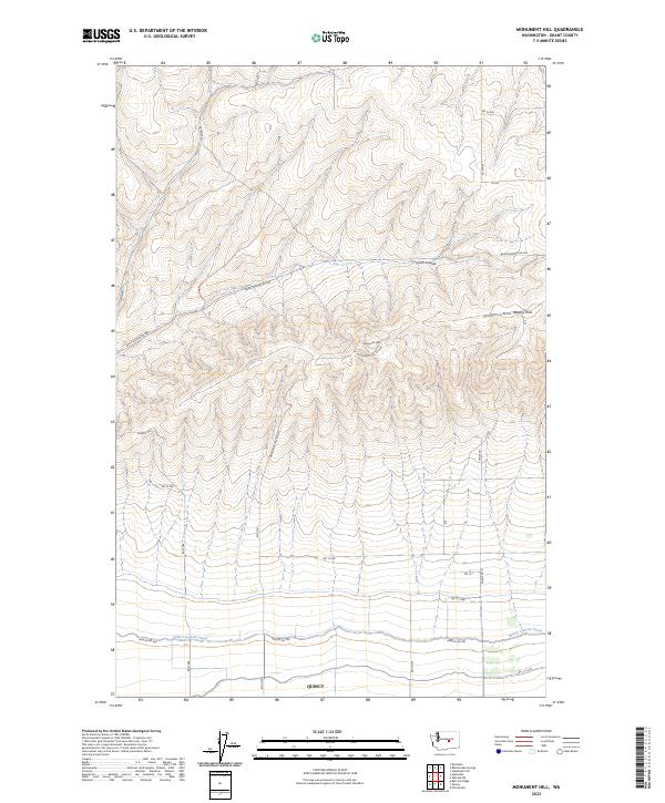
2023 Map of Monument Hill
USGS Topo · Published 2023About this map
Quincy anchors the southern edge of this landscape, where the flat agricultural plains of the Columbia Basin meet the rising elevation of the Beezley Hills. The transition from irrigated farmland to the higher, undulating terrain is marked by the Quincy Lateral Canal, an essential piece of water infrastructure that defines the local boundary between intensive cultivation and the arid slopes of Monument Hill.
Find a feature on this map
24 named features on this map. Tap any name to fly to it.
Don’t see what you’re looking for? This feature index may not catch every label — zoom into the map to look around manually.
Map Details
Editions of this 2023 Monument Hill Map
This is the sole edition of this map. No revisions or reprints were ever made.
Other maps of this area

1909 · Quincy
USGS Topo · 1:62,500

1910 · Quincy
USGS Topo · 1:62,500

1910 · Winchester
USGS Topo · 1:62,500

1953 · Ritzville
USGS Topo · 1:250,000

1956 · Ephrata
USGS Topo · 1:62,500

1956 · Ephrata SW
USGS Topo · 1:24,000

1959 · Ritzville
USGS Topo · 1:250,000

1965 · Ritzville
USGS Topo · 1:250,000
1966 · Winchester
USGS Topo · 1:24,000
1966 · Monument Hill
USGS Topo · 1:24,000