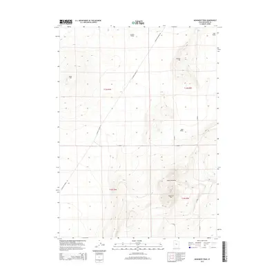
2014 Map of Monument Peak
USGS Topo · Published 2014About this map
Monument Peak dominates the southeastern quadrant of this terrain study in Box Elder County, marking the southern extent of the Hansel Mountains. The landscape transitions from these higher elevations into the broad, flat expanses of Curlew Valley to the northwest and Sage Valley to the east. Human activity is defined by a rigid grid of rural roads and section lines, most notably Locomotive Springs Rd, which cuts diagonally across the high desert topography. Notable landforms like Cedar Hill and Johnson Hill rise from the valley floors, providing navigational landmarks in an area otherwise characterized by vast open spaces and sparse infrastructure. The map clearly delineates the Township and Range boundaries, such as t12n r8w, which organize this section of the Great Basin into a predictable geometric layout.
Find a feature on this map
15 named features on this map. Tap any name to fly to it.
Don’t see what you’re looking for? This feature index may not catch every label — zoom into the map to look around manually.
Map Details
Editions of this 2014 Monument Peak Map
This is the sole edition of this map. No revisions or reprints were ever made.
Other maps of this area

1954 · Brigham City
USGS Topo · 1:250,000

1958 · Brigham City
USGS Topo · 1:250,000

1962 · Brigham City
USGS Topo · 1:250,000

1968 · Lake Ridge
USGS Topo · 1:24,000

1968 · Monument Point
USGS Topo · 1:24,000

1968 · Salt Wells
USGS Topo · 1:24,000

1968 · Monument Peak NW
USGS Topo · 1:24,000

1968 · Monument Peak SW
USGS Topo · 1:24,000

1968 · Snowville
USGS Topo · 1:24,000

1968 · Monument Peak
USGS Topo · 1:24,000