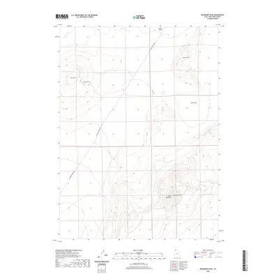
2020 Map of Monument Peak
USGS Topo · Published 2020About this map
Monument Peak rises as the central landmark within the southern reaches of the Hansel Mountains, anchoring a landscape defined by expansive high-desert basins. This area of northern Utah is characterized by the broad reaches of Curlew Valley to the north and Sage Valley to the east, illustrating the typical basin-and-range topography of Box Elder County. The mapping shows a sparsely developed region where transportation is dictated by long-distance thoroughfares like Locomotive Springs Rd, which skirts the western foothills. To the north, Johnson Hill and Cedar Hill stand as prominent rises above the valley floors, while Cedar Hill (East) Rd provides access to the higher elevations. The survey emphasizes the isolation of these peaks and the dominance of name-bearing terrain features over human settlements, preserving the character of the contemporary Utah backcountry.
Find a feature on this map
8 named features on this map. Tap any name to fly to it.
Don’t see what you’re looking for? This feature index may not catch every label — zoom into the map to look around manually.
Map Details
Editions of this 2020 Monument Peak Map
This is the sole edition of this map. No revisions or reprints were ever made.
Other maps of this area

1954 · Brigham City
USGS Topo · 1:250,000

1958 · Brigham City
USGS Topo · 1:250,000

1962 · Brigham City
USGS Topo · 1:250,000

1968 · Lake Ridge
USGS Topo · 1:24,000

1968 · Monument Point
USGS Topo · 1:24,000

1968 · Salt Wells
USGS Topo · 1:24,000

1968 · Monument Peak NW
USGS Topo · 1:24,000

1968 · Monument Peak SW
USGS Topo · 1:24,000

1968 · Snowville
USGS Topo · 1:24,000

1968 · Monument Peak
USGS Topo · 1:24,000