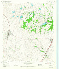
1965 Map of Moody
USGS Topo · Published 1967About this map
The borderlands of Mc Lennan Co and Bell Co are defined by a dual-railroad corridor and the headwaters of the Brazos River basin in the mid-1960s. The Atchison Topeka and Santa Fe railroad serves as the spine for Moody, where the local High School and several cemeteries anchor the community. To the east, the Missouri-Kansas-Texas line passes through Eddy and the small settlement of Hoolia. Between these transit lines, the landscape is carved by the South Fork Cow Bayou and Big Elm Creek. Cultural landmarks such as Liberty Hill Ch and Bethany Ch represent the rural social centers of this central Texas agricultural region, while numerous spillways and risers indicate a highly managed water drainage system across the prairie.
Find a feature on this map
23 named features on this map. Tap any name to fly to it.
Don’t see what you’re looking for? This feature index may not catch every label — zoom into the map to look around manually.
Map Details
Editions of this 1965 Moody Map
Other maps of this area

1892 · Temple
USGS Topo · 1:125,000

1924 · Temple 2-C
USGS Topo · 1:48,000

1924 · Temple 3-B
USGS Topo · 1:48,000

1931 · Mc Gregor
USGS Topo · 1:62,500

1931 · Belton
USGS Topo · 1:62,500

1954 · Waco
USGS Topo · 1:250,000

1955 · Waco
USGS Topo · 1:250,000

1957 · Bruceville
USGS Topo · 1:24,000

1957 · Lorena
USGS Topo · 1:24,000
1963 · Belfalls
USGS Topo · 1:24,000