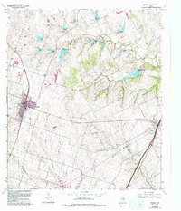
1965 Map of Moody
USGS Topo · Published 1993About this map
Moody and Eddy anchor this landscape along the border of McLennan, Bell, and Falls Counties during the mid-1960s, with later updates tracking the region's development. The western portion is defined by the Atchison Topeka and Santa Fe railroad corridor, which serves as the backbone for the community and local infrastructure like the Moody High Sch. To the east, the Missouri-Kansas-Texas line runs through the smaller settlement of Hoolia, illustrating the historical dependence on these competing rail systems for agricultural transport.
Find a feature on this map
23 named features on this map. Tap any name to fly to it.
Don’t see what you’re looking for? This feature index may not catch every label — zoom into the map to look around manually.
Map Details
Editions of this 1965 Moody Map
Other maps of this area

1892 · Temple
USGS Topo · 1:125,000

1924 · Temple 2-C
USGS Topo · 1:48,000

1924 · Temple 3-B
USGS Topo · 1:48,000

1931 · Mc Gregor
USGS Topo · 1:62,500

1931 · Belton
USGS Topo · 1:62,500

1954 · Waco
USGS Topo · 1:250,000

1955 · Waco
USGS Topo · 1:250,000

1957 · Bruceville
USGS Topo · 1:24,000

1957 · Lorena
USGS Topo · 1:24,000
1963 · Belfalls
USGS Topo · 1:24,000