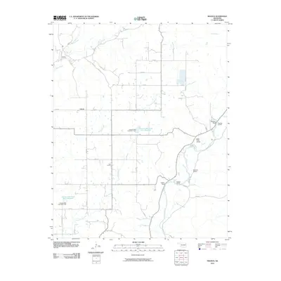
2010 Map of Moodys
USGS Topo · Published 2010About this map
The Illinois River snakes through the eastern portion of this landscape, carving a series of named hollows and bluffs including Molly Field Hollow, Telamay Hollow, and the prominent Eagles Bluff. This 2010 survey of the Cherokee County area reveals a rural region defined by its water systems, including the managed flow of Fourteenmile Creek with its specialized reservoirs at Fourteen Mile Creek Site 1 Reservoir and Fourteen Mile Creek Site 2 Reservoir.
Find a feature on this map
42 named features on this map. Tap any name to fly to it.
Don’t see what you’re looking for? This feature index may not catch every label — zoom into the map to look around manually.
Map Details
Editions of this 2010 Moodys Map
This is the sole edition of this map. No revisions or reprints were ever made.
Other maps of this area

1896 · Pryor
USGS Topo · 1:125,000

1898 · Tahlequah
USGS Topo · 1:125,000

1899 · Siloam Springs
USGS Topo · 1:125,000

1901 · Muscogee
USGS Topo · 1:125,000

1901 · Pryor
USGS Topo · 1:125,000

1901 · Tahlequah
USGS Topo · 1:125,000

1903 · Siloam Springs
USGS Topo · 1:125,000

1904 · Siloam Springs
USGS Topo · 1:125,000

1905 · Muscogee
USGS Topo · 1:125,000

1905 · Tahlequah
USGS Topo · 1:125,000