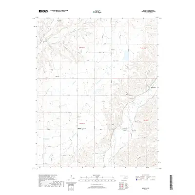
2019 Map of Moodys
USGS Topo · Published 2019About this map
The Illinois River winds through the eastern portion of this Cherokee County landscape, defining a terrain marked by steep hollows and high bluffs. Significant natural landmarks such as Hanging Rock and Eagles Bluff stand above the river and its tributaries, including Fourteenmile Cr and Spring Cr. Small rural settlements like Moodys, Lowrey, and Ellerville are interconnected by a network of local roads such as Moody RD and E 650 RD. For genealogists and local historians, the map identifies several local burial grounds, including Teresita Cem, Agent Cem, and Molly Field Cem. The presence of the Fourteen Mile Cr Site 1 Reservoir and Fourteen Mile Cr Site 2 Reservoir illustrates modern water management efforts within this historically agrarian and wooded region of Oklahoma.
Find a feature on this map
68 named features on this map. Tap any name to fly to it.
Don’t see what you’re looking for? This feature index may not catch every label — zoom into the map to look around manually.
Map Details
Editions of this 2019 Moodys Map
This is the sole edition of this map. No revisions or reprints were ever made.
Other maps of this area

1896 · Pryor
USGS Topo · 1:125,000

1898 · Tahlequah
USGS Topo · 1:125,000

1899 · Siloam Springs
USGS Topo · 1:125,000

1901 · Muscogee
USGS Topo · 1:125,000

1901 · Pryor
USGS Topo · 1:125,000

1901 · Tahlequah
USGS Topo · 1:125,000

1903 · Siloam Springs
USGS Topo · 1:125,000

1904 · Siloam Springs
USGS Topo · 1:125,000

1905 · Muscogee
USGS Topo · 1:125,000

1905 · Tahlequah
USGS Topo · 1:125,000