2022 Map of Moodys
USGS Topo · Published 2022About this map
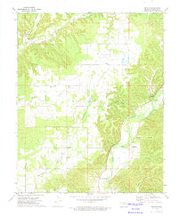
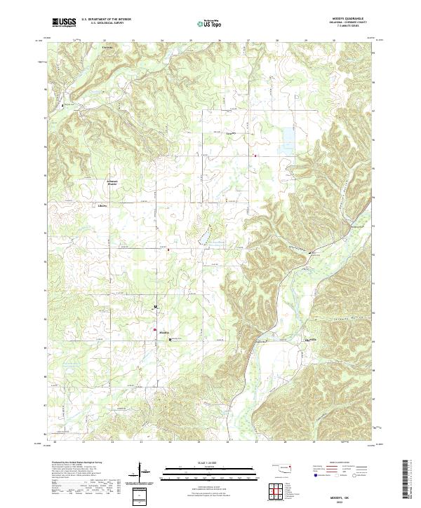
Moodys and its surrounding Cherokee County landscape are defined by a network of creek valleys and upland prairies in this recent survey. The terrain is marked by significant topographical shifts, from the broad elevation of Johnson Prairie to the steep bluffs overlooking the Illinois River, such as Eagles Bluff and Graveyard Bluff. Small communities like Teresita, Lowrey, and Liberty are connected by a grid of rural roads, including E Red Fuller Rd and N Elm Grove Rd. Genealogical interest is found in the distribution of family-named burial sites across the township lines, notably Moodys Cem, Agent Cem, and Molly Fields Cem. Water management is prominent in the central section where Fourteen Mile Cr Site 1 Reservoir and Fourteen Mile Cr Site 2 Reservoir regulate the flow of Fourteenmile Cr. The map also captures numerous named hollows, including Peavine Hollow and Telamay Hollow, which descend toward the river valley in the east.
Find a feature on this map
62 named features on this map. Tap any name to fly to it.
Don’t see what you’re looking for? This feature index may not catch every label — zoom into the map to look around manually.
Map Details
Editions of this 2022 Moodys Map
This is the sole edition of this map. No revisions or reprints were ever made.