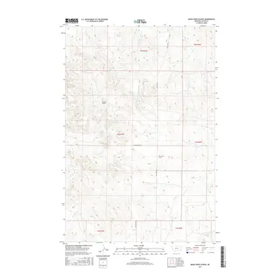
2017 Map of Moon Creek School
USGS Topo · Published 2017About this map
Moon Creek School stands as a focal point in this remote section of Custer County, situated near the intersection of Moon Creek Rd and Graveyard Creek Rd. This area of eastern Montana is defined by a dendritic drainage system where various branches of Cottonwood Cr, including the W Fork Cottonwood Cr and SW Fork Cottonwood Cr, carve through the high plains. The landscape is marked by distinct topographic features such as Horton Hollow and the drainage of Graveyard Cr. The survey illustrates a sparsely populated ranching environment where life is organized around the primary watercourses of Hay Cr, Moon Cr, and Shell Cr, reflecting the enduring rural character of the region in the early 21st century.
Find a feature on this map
17 named features on this map. Tap any name to fly to it.
Don’t see what you’re looking for? This feature index may not catch every label — zoom into the map to look around manually.
Map Details
Editions of this 2017 Moon Creek School Map
This is the sole edition of this map. No revisions or reprints were ever made.
Other maps of this area

1953 · Miles City
USGS Topo · 1:250,000

1954 · Forsyth
USGS Topo · 1:250,000

1957 · Miles City
USGS Topo · 1:250,000

1957 · Forsyth
USGS Topo · 1:250,000

1958 · Miles City
USGS Topo · 1:250,000

1958 · Forsyth
USGS Topo · 1:250,000

1968 · Hathaway
USGS Topo · 1:24,000

1968 · Lignite Creek
USGS Topo · 1:24,000

1968 · Horton
USGS Topo · 1:24,000
1969 · Jack Creek NW
USGS Topo · 1:24,000