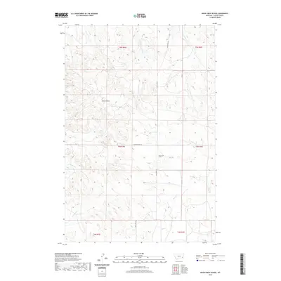
2020 Map of Moon Creek School
USGS Topo · Published 2020About this map
Moon Creek School stands as a focal point in this portion of Custer County, serving a landscape defined by an intricate network of drainage systems. The topography is dominated by the deeply carved ridges and valleys of the Big Horn Basin foothills, where features like Horton Hollow shape the movement of local traffic. Access to these remote reaches is maintained via Moon Creek Rd and Graveyard Creek Rd, which follow the natural contours of the land. This survey provides a clear view of the complex hydrography in the region, capturing the courses of Moon Cr, Graveyard Cr, and Cottonwood Cr before they join larger systems. The map illustrates the persistent importance of school locations and section lines in organizing the vast ranching country of eastern Montana.
Find a feature on this map
16 named features on this map. Tap any name to fly to it.
Don’t see what you’re looking for? This feature index may not catch every label — zoom into the map to look around manually.
Map Details
Editions of this 2020 Moon Creek School Map
This is the sole edition of this map. No revisions or reprints were ever made.
Other maps of this area

1953 · Miles City
USGS Topo · 1:250,000

1954 · Forsyth
USGS Topo · 1:250,000

1957 · Miles City
USGS Topo · 1:250,000

1957 · Forsyth
USGS Topo · 1:250,000

1958 · Miles City
USGS Topo · 1:250,000

1958 · Forsyth
USGS Topo · 1:250,000

1968 · Hathaway
USGS Topo · 1:24,000

1968 · Lignite Creek
USGS Topo · 1:24,000

1968 · Horton
USGS Topo · 1:24,000
1969 · Jack Creek NW
USGS Topo · 1:24,000