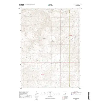
2017 Map of Moonshine Peak
USGS Topo · Published 2017About this map
The Laramie River winds through the high-elevation terrain of Albany County, defining a landscape of deep gulches and prominent summits. This 2017 survey details a network of drainage systems, including Bluegrass Cr and Slate Cr, which carve through the territory between Moonshine Peak and Government Peak. The map captures the meeting point of the Albany and Platte county lines, providing a clear view of the complex topography that dictates the path of local corridors like Tunnel Rd and Government Peak Rd. Geologists and land researchers can trace the specific drainages of Bradbury Gulch and Moonshine Gulch, alongside the remote canyon systems of White Hound Canyon. The reliance on unpaved access routes like Duck Creek Rd underscores the sparse, rugged nature of this interior Wyoming landscape.
Find a feature on this map
24 named features on this map. Tap any name to fly to it.
Don’t see what you’re looking for? This feature index may not catch every label — zoom into the map to look around manually.
Map Details
Editions of this 2017 Moonshine Peak Map
This is the sole edition of this map. No revisions or reprints were ever made.
Other maps of this area

1953 · Natwick SW
USGS Topo · 1:24,000

1953 · Squaw Rock
USGS Topo · 1:24,000

1953 · Hightower SW
USGS Topo · 1:24,000

1954 · Torrington
USGS Topo · 1:250,000

1954 · Cheyenne
USGS Topo · 1:250,000

1955 · Poe Mountain
USGS Topo · 1:24,000

1955 · Moonshine Peak
USGS Topo · 1:24,000

1955 · Guide Rock
USGS Topo · 1:24,000

1955 · Bull Camp Peak
USGS Topo · 1:24,000

1958 · Cheyenne
USGS Topo · 1:250,000