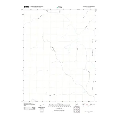
2011 Map of Moonwater Point
USGS Topo · Published 2011About this map
Moonwater Point and Chandler Point define the high, dissected plateaus of Uintah County in this early 21st-century record. The landscape is characterized by a complex network of deep drainages, including Chandler Canyon and Deep Canyon, which drop away from the prominent ridges. These canyons serve as the primary geographical markers in a territory largely defined by its hydrological features rather than human settlements. Critical water sources such as Anna Laura Spring, Pinto Springs, and Slough Canyon Spring are noted throughout the terrain, alongside smaller named features like Marys Water. The drainage patterns of Bluebell Creek, Joe Hutch Creek, and Florence Creek illustrate the erosional forces that have shaped this portion of the Uinta Basin's edge, where the topography transitions through numerous smaller draws like Burnt Canyon and Papoose Canyon.
Find a feature on this map
20 named features on this map. Tap any name to fly to it.
Don’t see what you’re looking for? This feature index may not catch every label — zoom into the map to look around manually.
Map Details
Editions of this 2011 Moonwater Point Map
This is the sole edition of this map. No revisions or reprints were ever made.
Other maps of this area

1885 · East Tavaputs
USGS Topo · 1:250,000

1886 · Price River
USGS Topo · 1:250,000

1896 · Price River
USGS Topo · 1:250,000

1953 · Firewater Canyon
USGS Topo · 1:62,500

1954 · Flat Canyon
USGS Topo · 1:62,500

1954 · Range Creek
USGS Topo · 1:62,500

1956 · Price
USGS Topo · 1:250,000

1956 · Grand Junction
USGS Topo · 1:250,000

1959 · Grand Junction
USGS Topo · 1:250,000

1960 · Price
USGS Topo · 1:250,000