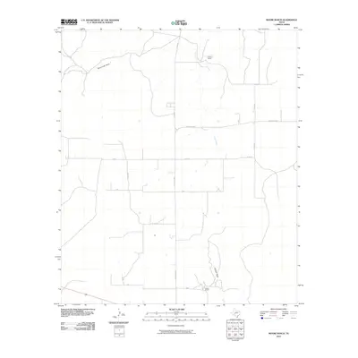
2010 Map of Moore Ranch
USGS Topo · Published 2010About this map
The sprawling ranching landscape of Schleicher County is defined by a network of intermittent watercourses and large private holdings. Moore Ranch and Linthicum Ranch anchor the southern and northern reaches of this survey, reflecting the deep-rooted cattle and livestock heritage of West Texas. Drainage patterns like Dove Creek Draw and Granger Draw carve through the plateau, providing essential natural orientation in a territory where roads follow a rigid, surveyed grid. A series of rural routes, including Ranch Rd 1828 and Co Rd 427, connect these remote homesteads, illustrating the infrastructure required to manage vast tracts of land in the early 21st century.
Find a feature on this map
11 named features on this map. Tap any name to fly to it.
Don’t see what you’re looking for? This feature index may not catch every label — zoom into the map to look around manually.
Map Details
Editions of this 2010 Moore Ranch Map
This is the sole edition of this map. No revisions or reprints were ever made.
Other maps of this area

1895 · Sherwood
USGS Topo · 1:125,000

1954 · Sonora
USGS Topo · 1:250,000

1954 · San Angelo
USGS Topo · 1:250,000

1958 · Sonora
USGS Topo · 1:250,000

1958 · San Angelo
USGS Topo · 1:250,000

1964 · Eldorado NW
USGS Topo · 1:24,000

1964 · Eldorado SW
USGS Topo · 1:24,000

1964 · Oglesby Ranch
USGS Topo · 1:24,000

1964 · Coupe Ranch
USGS Topo · 1:24,000

1964 · Bailey Draw
USGS Topo · 1:24,000