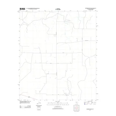
2012 Map of Moore Ranch
USGS Topo · Published 2012About this map
Moore Ranch and Linthicum Ranch anchor this landscape in Schleicher County, illustrating the enduring agricultural patterns of the Texas Edwards Plateau. The terrain is defined by the ephemeral drainage of Dove Cr, which winds through a network of rural routes and property access roads. Local infrastructure is represented by Ranch Road 1828 and several county roads, including Co Rd 425 and Co Rd 423. The inclusion of Bootleggers Ln provides a suggestive detail of local nomenclature in this sparsely populated cattle and sheep ranching region. This 2012 survey captures the modern configuration of established family landholdings and the sparse water features that dictate the layout of rural Texas ranching life.
Find a feature on this map
9 named features on this map. Tap any name to fly to it.
Don’t see what you’re looking for? This feature index may not catch every label — zoom into the map to look around manually.
Map Details
Editions of this 2012 Moore Ranch Map
This is the sole edition of this map. No revisions or reprints were ever made.
Other maps of this area

1895 · Sherwood
USGS Topo · 1:125,000

1954 · Sonora
USGS Topo · 1:250,000

1954 · San Angelo
USGS Topo · 1:250,000

1958 · Sonora
USGS Topo · 1:250,000

1958 · San Angelo
USGS Topo · 1:250,000

1964 · Eldorado NW
USGS Topo · 1:24,000

1964 · Eldorado SW
USGS Topo · 1:24,000

1964 · Oglesby Ranch
USGS Topo · 1:24,000

1964 · Coupe Ranch
USGS Topo · 1:24,000

1964 · Bailey Draw
USGS Topo · 1:24,000