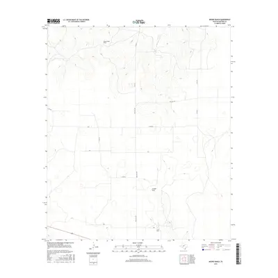
2016 Map of Moore Ranch
USGS Topo · Published 2016About this map
Moore Ranch serves as a primary geographic anchor for this section of Schleicher County, illustrating the continued significance of large agricultural and ranching properties in the Texas Edwards Plateau. The landscape is defined by its drainage patterns, with the northern terrain carved by Dove Creek Draw and the intermittent flows of Dove Cr, while Granger Draw cuts through the central portion of the quadrangle. These natural features dictate the placement of local infrastructure, including a network of rural routes such as Ranch Rd 1828 and several county roads like Co Rd 427. The topographic detail reveals the subtle elevation changes and dry wash systems that characterize this ranching country, showing how human settlement and transportation have adapted to the persistent aridity and drainage of the West Texas plains.
Find a feature on this map
10 named features on this map. Tap any name to fly to it.
Don’t see what you’re looking for? This feature index may not catch every label — zoom into the map to look around manually.
Map Details
Editions of this 2016 Moore Ranch Map
This is the sole edition of this map. No revisions or reprints were ever made.
Other maps of this area

1895 · Sherwood
USGS Topo · 1:125,000

1954 · Sonora
USGS Topo · 1:250,000

1954 · San Angelo
USGS Topo · 1:250,000

1958 · Sonora
USGS Topo · 1:250,000

1958 · San Angelo
USGS Topo · 1:250,000

1964 · Eldorado NW
USGS Topo · 1:24,000

1964 · Eldorado SW
USGS Topo · 1:24,000

1964 · Oglesby Ranch
USGS Topo · 1:24,000

1964 · Coupe Ranch
USGS Topo · 1:24,000

1964 · Bailey Draw
USGS Topo · 1:24,000