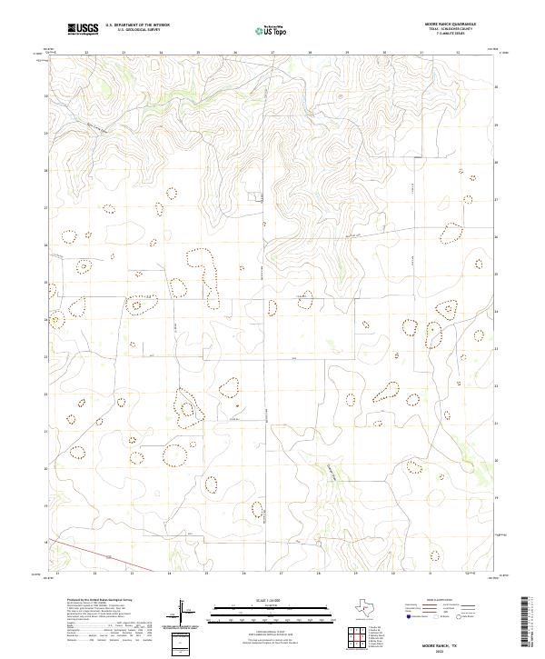
2022 Map of Moore Ranch
USGS Topo · Published 2022About this map
Intermittent drainages and high plains ranching infrastructure characterize this portion of the Edwards Plateau. The landscape is defined by the winding course of Dove Cr and its larger northern tributary, Dove Creek Draw. These seasonal waterways are joined further south by Granger Draw, illustrating the natural drainage patterns that have dictated land use in this part of Schleicher County for generations. A geometric network of rural corridors, including Ranch RD 1828 and several county roads such as Co Rd 425 and Co Rd 427, provides access to private ranching estates. The map highlights the localized geography of a working landscape where topography and road placements reflect the boundaries of large-scale cattle or sheep operations in West Texas.
Find a feature on this map
14 named features on this map. Tap any name to fly to it.
Don’t see what you’re looking for? This feature index may not catch every label — zoom into the map to look around manually.
Map Details
Editions of this 2022 Moore Ranch Map
This is the sole edition of this map. No revisions or reprints were ever made.
Other maps of this area

1895 · Sherwood
USGS Topo · 1:125,000

1954 · Sonora
USGS Topo · 1:250,000

1954 · San Angelo
USGS Topo · 1:250,000

1958 · Sonora
USGS Topo · 1:250,000

1958 · San Angelo
USGS Topo · 1:250,000

1964 · Eldorado NW
USGS Topo · 1:24,000

1964 · Eldorado SW
USGS Topo · 1:24,000

1964 · Oglesby Ranch
USGS Topo · 1:24,000

1964 · Coupe Ranch
USGS Topo · 1:24,000

1964 · Bailey Draw
USGS Topo · 1:24,000