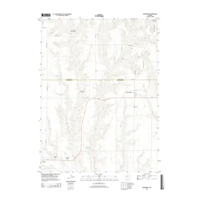
2014 Map of Moorefield
USGS Topo · Published 2014About this map
Moorefield and the outskirts of Curtis anchor this landscape along the border of Lincoln and Frontier counties. The terrain is defined by a dense network of canyons and draws, most notably East Curtis Creek Canyon and Curtis Creek Canyon, which drain into the valley of Medicine Creek. Water management is prominent throughout the area, evidenced by the presence of Elson Detention Reservoir 1-N, Elson Reservoir Number 1-S, and Medicine Cr Reservoir 200. The small village of Moorefield is depicted with its grid of streets including Ash St and Market St, while the local Moorefield Cem sits just to the south. Further west, the Curtis Municipal Airport serves as a key local landmark near Tobiassen Draw, reflecting the infrastructure of this agricultural and ranching region of Nebraska.
Find a feature on this map
30 named features on this map. Tap any name to fly to it.
Don’t see what you’re looking for? This feature index may not catch every label — zoom into the map to look around manually.
Map Details
Editions of this 2014 Moorefield Map
This is the sole edition of this map. No revisions or reprints were ever made.
Other maps of this area

1902 · Gothenburg
USGS Topo · 1:125,000

1954 · McCook
USGS Topo · 1:250,000

1956 · Jeffrey Reservoir SW
USGS Topo · 1:24,000

1956 · Stockville NE
USGS Topo · 1:24,000

1956 · Moorefield
USGS Topo · 1:24,000

1956 · Curtis
USGS Topo · 1:24,000

1956 · Curtis SE
USGS Topo · 1:24,000

1956 · Stockville
USGS Topo · 1:24,000

1956 · Wellfleet SE
USGS Topo · 1:24,000

1956 · Stockville SE
USGS Topo · 1:24,000