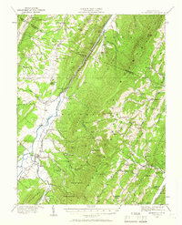
1920 Map of Moorefield
USGS Topo · Published 1966About this map
Moorefield serves as the focal point of this 1920 survey, situated at the confluence of the South Fork and the South Branch Potomac River. The landscape is defined by the sharp parallel ridges of Mill Creek Mountain and Nathaniel Mountain, which frame the agricultural Moorefield Valley. The map reveals a dense network of early 20th-century rural infrastructure, specifically highlighting the numerous neighborhood schools like New Lane School, Thrasher Spring School, and Phils Lick School that served isolated hollows.
Find a feature on this map
96 named features on this map. Tap any name to fly to it.
Don’t see what you’re looking for? This feature index may not catch every label — zoom into the map to look around manually.
Map Details
Editions of this 1920 Moorefield Map
2 editions found
Other maps of this area

1891 · Romney
USGS Topo · 1:125,000

1892 · Franklin
USGS Topo · 1:125,000

1892 · Woodstock
USGS Topo · 1:125,000

1895 · Piedmont
USGS Topo · 1:125,000

1896 · Franklin
USGS Topo · 1:125,000

1919 · Elk Garden
USGS Topo · 1:48,000

1920 · Elk Garden
USGS Topo · 1:48,000

1920 · Petersburg
USGS Topo · 1:48,000

1920 · Moorefield
USGS Topo · 1:62,500

1920 · Keyser
USGS Topo · 1:62,500