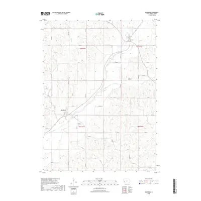
2018 Map of Moorhead
USGS Topo · Published 2018About this map
Moorhead and Soldier serve as the primary hubs of this western Iowa landscape, where the deeply dissected Loess Hills terrain dictates the path of every road and creek. The Soldier River provides the dominant drainage through the center of the region, flanked by winding tributaries like Jordan Cr and Norway Cr. This 2018 survey reveals a rural infrastructure defined by a grid of numbered roads, such as 250th St and 330th St, which must navigate the sharp relief of the surrounding ridges.
Find a feature on this map
30 named features on this map. Tap any name to fly to it.
Don’t see what you’re looking for? This feature index may not catch every label — zoom into the map to look around manually.
Map Details
Editions of this 2018 Moorhead Map
This is the sole edition of this map. No revisions or reprints were ever made.
Other maps of this area

1954 · Omaha
USGS Topo · 1:250,000

1954 · Fort Dodge
USGS Topo · 1:250,000

1957 · Omaha
USGS Topo · 1:250,000

1957 · Fort Dodge
USGS Topo · 1:250,000

1958 · Omaha
USGS Topo · 1:250,000

1958 · Fort Dodge
USGS Topo · 1:250,000

1969 · Castana
USGS Topo · 1:24,000
1971 · Mapleton SE
USGS Topo · 1:24,000

1971 · Moorhead SE
USGS Topo · 1:24,000

1971 · Ute
USGS Topo · 1:24,000