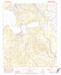
1982 Map of Mooringsport
USGS Topo · Published 1982About this map
Mooringsport and Oil City anchor the northwestern reaches of Caddo Parish, marking a landscape defined by the expansive waters of Caddo Lake. This early 1980s survey illustrates a region where heavy industry and natural floodplains meet, featuring an intricate network of drainage and transport routes like the Shiftail Canal and the Shreveport Waterway. The terrain transitions from the elevated Pine Island in the north to the low-lying wetlands of Soda Lake and the State Wildlife Management Area to the southeast. Local history researchers will find a complex hydraulic environment where numerous water bodies, including Stumpy Bayou, Black Bayou, and Twelvemile Bayou, dictate the settlement patterns. The map also records smaller geographic points like Myricks and Rocky Point, providing a detailed look at the rural land divisions and waterway engineering prevalent in the late twentieth century.
Find a feature on this map
28 named features on this map. Tap any name to fly to it.
Don’t see what you’re looking for? This feature index may not catch every label — zoom into the map to look around manually.
Map Details
Editions of this 1982 Mooringsport Map
2 editions found
Other maps of this area

1932 · Shreveport SE
USGS Topo · 1:31,680

1932 · Hosston SW
USGS Topo · 1:31,680

1932 · Hosston SE
USGS Topo · 1:31,680

1932 · Shreveport NE
USGS Topo · 1:31,680

1944 · Kildare
USGS Topo · 1:62,500

1944 · Caddo Lake
USGS Topo · 1:62,500

1946 · Caddo Lake
USGS Topo · 1:62,500

1948 · Kildare
USGS Topo · 1:62,500

1948 · Mooringsport
USGS Topo · 1:62,500

1948 · Vivian
USGS Topo · 1:62,500