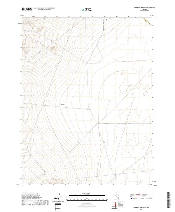
2021 Map of Moorman Spring NW
USGS Topo · Published 2021About this map
White River Valley dominates this section of the high desert, where the topographical contours reveal a vast basin floor flanked by rising slopes. This 2021 survey of the region captures the stark transition between the valley floor and the surrounding high ground, particularly at The Cove, a distinct landform where the terrain draws together along the western edge of the valley. The map is primarily defined by the intersection of the White Pine and Nye county line, tracing the legal geography across a landscape otherwise marked by public land survey townships and desert flats. This region is characterized by its isolation and the broad, open drainage patterns that define the hydrological character of south-central Nevada.
Find a feature on this map
7 named features on this map. Tap any name to fly to it.
Don’t see what you’re looking for? This feature index may not catch every label — zoom into the map to look around manually.
Map Details
Editions of this 2021 Moorman Spring NW Map
This is the sole edition of this map. No revisions or reprints were ever made.
Other maps of this area

1956 · Lund
USGS Topo · 1:250,000

1957 · Currant Mtn
USGS Topo · 1:62,500

1960 · Lund
USGS Topo · 1:250,000

1964 · Currant
USGS Topo · 1:62,500

1964 · Currant Mtn
USGS Topo · 1:62,500

1969 · Moorman Spring SE
USGS Topo · 1:24,000

1969 · Moorman Spring NW
USGS Topo · 1:24,000

1969 · Moorman Spring
USGS Topo · 1:24,000

1969 · Moorman Spring NE
USGS Topo · 1:24,000
1978 · Lund
USGS Topo · 1:24,000