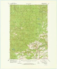
1964 Map of Moquah
USGS Topo · Published 1965About this map
Chequamegon National Forest dominates this mid-1960s landscape, where dense timber is punctuated by fire towers and remote guard stations. The northern portion of the map is defined by the high ground of Mt Valhalla and the Washburn Lookout Tower, overlooking a glaciated terrain of small lakes like Crystal Lake and Hoist Lake 2. Further south, the map reveals the industrial and religious focal points of the settler community, including the St Peters Ch and St Florian Ch located near the railway corridors.
Find a feature on this map
55 named features on this map. Tap any name to fly to it.
Don’t see what you’re looking for? This feature index may not catch every label — zoom into the map to look around manually.
Map Details
Editions of this 1964 Moquah Map
This is the sole edition of this map. No revisions or reprints were ever made.
Other maps of this area

1941 · Bayfield
USGS Topo · 1:48,000

1942 · Ashland
USGS Topo · 1:48,000

1942 · Marengo
USGS Topo · 1:48,000

1943 · Port Wing
USGS Topo · 1:48,000

1943 · Iron Lake
USGS Topo · 1:48,000

1944 · Moquah
USGS Topo · 1:48,000

1944 · Cornucopia
USGS Topo · 1:48,000

1944 · Drummond
USGS Topo · 1:48,000

1944 · Grandview
USGS Topo · 1:48,000

1945 · Marengo
USGS Topo · 1:48,000