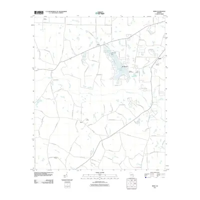
2011 Map of Mora
USGS Topo · Published 2011About this map
The Satilla River carves a winding path through this Coffee County landscape, defining a region where water and local heritage are closely intertwined. In the early 21st century, the settlement of Mora serves as a central point for the surrounding rural area, characterized by a network of creeks including Reedy Creek, Bear Creek, and Mill Creek. The map reveals a high density of burial grounds, such as Mora Cemetery, Saint Illa Cemetery, and Hebron Cemetery, which provide significant points of interest for genealogical research and local history. To the east, recreational and residential development is evident around Holiday Beach North Lake and Hilliards Pond in the Bay Meadows area. Further south, the community of Oberry sits near the headwaters of Dark Bay, while the eastern edge is anchored by the community of Bethel, illustrating a settlement pattern of small, dispersed hamlets connected by traditional county roads.
Find a feature on this map
89 named features on this map. Tap any name to fly to it.
Don’t see what you’re looking for? This feature index may not catch every label — zoom into the map to look around manually.
Map Details
Editions of this 2011 Mora Map
This is the sole edition of this map. No revisions or reprints were ever made.
Other maps of this area

1953 · Waycross
USGS Topo · 1:250,000

1958 · Waycross
USGS Topo · 1:250,000

1971 · Douglas North
USGS Topo · 1:24,000

1971 · Douglas South
USGS Topo · 1:24,000

1971 · Pearson
USGS Topo · 1:24,000

1972 · Kirkland
USGS Topo · 1:24,000

1972 · Willacoochee
USGS Topo · 1:24,000

1972 · Lax
USGS Topo · 1:24,000

1972 · Ambrose
USGS Topo · 1:24,000

1972 · Mora
USGS Topo · 1:24,000