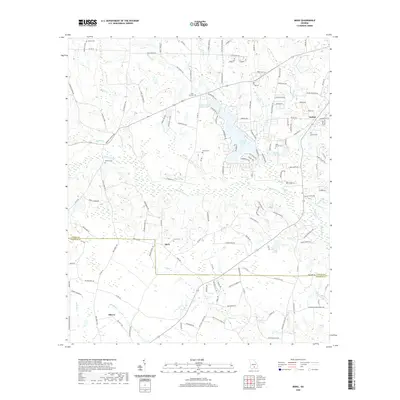
2020 Map of Mora
USGS Topo · Published 2020About this map
The Satilla River meanders across this rural landscape at the border of Coffee and Atkinson counties, anchoring a network of small agricultural settlements and family landmarks. The village of Mora sits centrally along Mora Rd, characterized by its local church and Mora Cem. To the northeast, the community of Bethel is defined by the Bethel Cem and nearby Holiday Beach Lake, while Oberry occupies the southwestern corner of the quadrangle.
Find a feature on this map
146 named features on this map. Tap any name to fly to it.
Don’t see what you’re looking for? This feature index may not catch every label — zoom into the map to look around manually.
Map Details
Editions of this 2020 Mora Map
This is the sole edition of this map. No revisions or reprints were ever made.
Other maps of this area

1953 · Waycross
USGS Topo · 1:250,000

1958 · Waycross
USGS Topo · 1:250,000

1971 · Douglas North
USGS Topo · 1:24,000

1971 · Douglas South
USGS Topo · 1:24,000

1971 · Pearson
USGS Topo · 1:24,000

1972 · Kirkland
USGS Topo · 1:24,000

1972 · Willacoochee
USGS Topo · 1:24,000

1972 · Lax
USGS Topo · 1:24,000

1972 · Ambrose
USGS Topo · 1:24,000

1972 · Mora
USGS Topo · 1:24,000