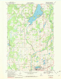
1968 Map of Mora North
USGS Topo · Published 1982About this map
Mora anchors the southern edge of this Kanabec County landscape, where the Great Northern railroad and several major waterways converge. The sheet is defined by the expansive waters of Knife Lake and the winding courses of the Snake River and Knife River. Local social and civic centers are well-documented, including Hillman Ch, the Knife Lake Cem, and the Townhall located near the river's bend.
Find a feature on this map
29 named features on this map. Tap any name to fly to it.
Don’t see what you’re looking for? This feature index may not catch every label — zoom into the map to look around manually.
Map Details
Editions of this 1968 Mora North Map
2 editions found
Other maps of this area

1953 · Duluth
USGS Topo · 1:250,000

1953 · Stillwater
USGS Topo · 1:250,000

1955 · Stillwater
USGS Topo · 1:250,000

1958 · Stillwater
USGS Topo · 1:250,000

1958 · Duluth
USGS Topo · 1:250,000

1961 · Brook Park
USGS Topo · 1:62,500

1965 · Stillwater
USGS Topo · 1:250,000

1968 · Ann Lake
USGS Topo · 1:24,000

1968 · Isle SW
USGS Topo · 1:24,000

1968 · Mora North
USGS Topo · 1:24,000