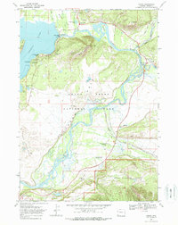
1968 Map of Moran
USGS Topo · Published 1972About this map
Grand Teton National Park dominates this late-1960s survey, revealing a landscape defined by the winding course of the Snake River and its confluence with Pacific Creek. The map documents a period of established park infrastructure and private ranching interests, featuring the Cunningham Cabin (Historic Site) and several active guest operations such as Moose Head Ranch and Triangle X Ranch. To the north, the Jackson Lake Dam regulates the waters of Jackson Lake, while nearby Signal Mtn Lodge and the Signal Mountain Campground mark the hub of visitor activity.
Find a feature on this map
42 named features on this map. Tap any name to fly to it.
Don’t see what you’re looking for? This feature index may not catch every label — zoom into the map to look around manually.
Map Details
Editions of this 1968 Moran Map
2 editions found
Other maps of this area

1899 · Grand Teton
USGS Topo · 1:125,000

1901 · Grand Teton
USGS Topo · 1:125,000

1902 · Mt Leidy
USGS Topo · 1:125,000

1955 · Driggs
USGS Topo · 1:250,000

1958 · Driggs
USGS Topo · 1:250,000

1962 · Driggs
USGS Topo · 1:250,000

1965 · Davis Hill
USGS Topo · 1:24,000

1965 · Mount Leidy
USGS Topo · 1:24,000
1965 · Whetstone Mountain
USGS Topo · 1:24,000

1968 · Moose
USGS Topo · 1:24,000