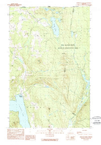
1989 Map of Morgan Center
USGS Topo · Published 1989About this map
Morgan Center sits along the northern shores of Seymour Lake, serving as a central point of settlement in this remote corner of Orleans County during the late 1980s. The landscape is defined by its transition from the agricultural and residential pockets near the water to the extensive timberlands and conservation tracts of the Bill Sladyk State Wildlife Management Area. To the north, the international border between the Canada United States is traced by monuments, cutting through a lake-heavy wilderness that includes Holland Pond and Turtle Pond.
Find a feature on this map
40 named features on this map. Tap any name to fly to it.
Don’t see what you’re looking for? This feature index may not catch every label — zoom into the map to look around manually.
Map Details
Editions of this 1989 Morgan Center Map
2 editions found
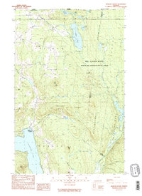
Other maps of this area

1919 · Lake Memphremagog
USGS Topo · 1:62,500

1920 · Derby
USGS Topo · 1:62,500

1923 · Lake Memphremagog
USGS Topo · 1:48,000

1924 · Island Pond
USGS Topo · 1:48,000

1925 · Memphremagog
USGS Topo · 1:62,500

1926 · Island Pond
USGS Topo · 1:62,500

1949 · Jackman
USGS Topo · 1:250,000

1950 · Lake Champlain
USGS Topo · 1:250,000

1950 · Lewiston
USGS Topo · 1:250,000

1953 · Island Pond
USGS Topo · 1:62,500