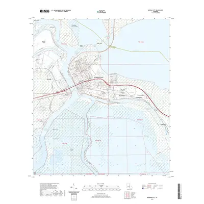
2020 Map of Morgan City
USGS Topo · Published 2020About this map
Berwick Bay serves as the central focal point of this coastal Louisiana landscape, separating the communities of Berwick and Morgan City. The intricate relationship between the land and the surrounding marsh is documented through the expansive Atchafalaya Basin Floodway and the critical shipping artery of the Gulf Intracoastal Waterway. This survey details the urban layout of several neighborhoods including Wyandotte, Siracusaville, and Greenwood, as well as the more industrial developments along Bayou Boeuf.
Find a feature on this map
120 named features on this map. Tap any name to fly to it.
Don’t see what you’re looking for? This feature index may not catch every label — zoom into the map to look around manually.
Map Details
Editions of this 2020 Morgan City Map
This is the sole edition of this map. No revisions or reprints were ever made.
Other maps of this area

1935 · Morgan City
USGS Topo · 1:62,500

1941 · Belle Isle
USGS Topo · 1:62,500

1945 · New Orleans
USGS Topo · 1:250,000

1948 · Foster
USGS Topo · 1:62,500

1953 · Napoleonville
USGS Topo · 1:62,500

1954 · Morgan City
USGS Topo · 1:62,500

1954 · Belle Isle
USGS Topo · 1:62,500

1959 · Foster
USGS Topo · 1:62,500

1963 · New Orleans
USGS Topo · 1:250,000
1965 · Grassy Lake
USGS Topo · 1:24,000