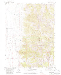
1972 Map of Morgan Pass
USGS Topo · Published 1986About this map
Shafter Well and Shafter Well No 2 stand as remote points of human presence in this arid region of Elko County during the early 1970s. The landscape is defined by the high ridges of the Toana Range and the Goshute Mountains, where the scarcity of water is evidenced by the prominence of named water sources like Rock Spring. This survey, based on 1970 aerial photography, captures a moment before modern infrastructure altered these high-desert drainage patterns, preserving the locations of essential ranching or surveying landmarks in a territory where such features were the primary indicators of human activity.
Find a feature on this map
3 named features on this map. Tap any name to fly to it.
Don’t see what you’re looking for? This feature index may not catch every label — zoom into the map to look around manually.
Map Details
Editions of this 1972 Morgan Pass Map
2 editions found
Other maps of this area

1955 · Elko
USGS Topo · 1:250,000

1958 · Elko
USGS Topo · 1:250,000

1962 · Elko
USGS Topo · 1:250,000

1965 · Elko
USGS Topo · 1:250,000

1971 · West Morris Basin
USGS Topo · 1:24,000

1971 · Shafter
USGS Topo · 1:24,000

1971 · Pilot
USGS Topo · 1:24,000

1971 · Decoy
USGS Topo · 1:24,000

1972 · Morgan Pass
USGS Topo · 1:24,000

1972 · Lion Spring
USGS Topo · 1:24,000