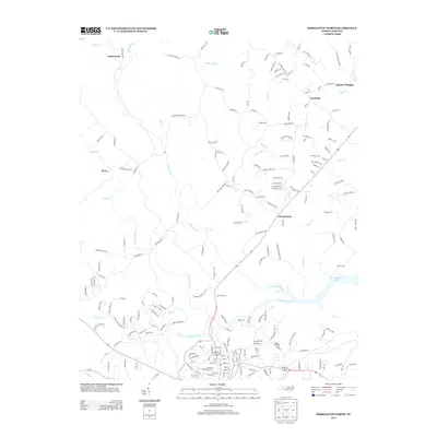
2013 Map of Morganton North
USGS Topo · Published 2013About this map
The Johns River and Catawba River converge in this northern Burke County landscape, defining a region where water and topography dictate the layout of rural communities. The map captures the suburban and rural interface north of Morganton, where the Catawba River flows into the upper reaches of Rhodhiss Lake. Established settlements like Chesterfield and Hartland are connected by a web of local roads, including the historical corridor of Old Oaks Farm Rd and the appropriately named Worry. Significant drainage features such as Warrior Fork, Wilson Cr, and White Mill Cr carve through the terrain, illustrating the complex hydrography that once supported local milling operations. This 2013 survey provides a clear view of modern property development and infrastructure, such as Spencer Heights, set against the permanent landmarks of the North Carolina foothills.
Find a feature on this map
199 named features on this map. Tap any name to fly to it.
Don’t see what you’re looking for? This feature index may not catch every label — zoom into the map to look around manually.
Map Details
Editions of this 2013 Morganton North Map
This is the sole edition of this map. No revisions or reprints were ever made.
Other maps of this area

1905 · Morganton
USGS Topo · 1:125,000

1953 · Charlotte
USGS Topo · 1:250,000

1954 · Charlotte
USGS Topo · 1:250,000

1956 · Valdese
USGS Topo · 1:24,000

1956 · Oak Hill
USGS Topo · 1:24,000

1956 · Collettsville
USGS Topo · 1:24,000

1956 · Morganton North
USGS Topo · 1:24,000

1956 · Morganton South
USGS Topo · 1:24,000

1956 · Lenoir
USGS Topo · 1:24,000
1956 · Chestnut Mtn.
USGS Topo · 1:24,000