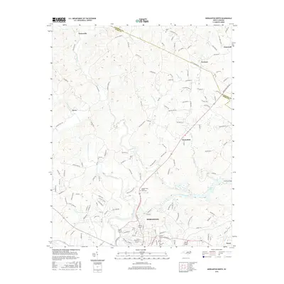
2016 Map of Morganton North
USGS Topo · Published 2016About this map
Morganton serves as the focal point for this survey of the Foothills region, situated where the Catawba River flows eastward into Rhodhiss Lake. The landscape is defined by the convergence of several major waterways, including the Johns River and Warrior Fork, which carve through the terrain north of the city. Genealogists will find a high concentration of burial sites throughout the rural outskirts, from the Catawba Valley Baptist Church Cem near the river to more isolated locations like Bost Cem and Erwin Cem. Small communities such as Chesterfield, Hartland, and Perkinsville dot the network of country roads, while the northern boundary is marked by the presence of Chestnut Mountain. The map captures a mix of established neighborhoods and the winding river valleys that have historically dictated the growth of Burke and Caldwell counties.
Find a feature on this map
140 named features on this map. Tap any name to fly to it.
Don’t see what you’re looking for? This feature index may not catch every label — zoom into the map to look around manually.
Map Details
Editions of this 2016 Morganton North Map
This is the sole edition of this map. No revisions or reprints were ever made.
Other maps of this area

1905 · Morganton
USGS Topo · 1:125,000

1953 · Charlotte
USGS Topo · 1:250,000

1954 · Charlotte
USGS Topo · 1:250,000

1956 · Valdese
USGS Topo · 1:24,000

1956 · Oak Hill
USGS Topo · 1:24,000

1956 · Collettsville
USGS Topo · 1:24,000

1956 · Morganton North
USGS Topo · 1:24,000

1956 · Morganton South
USGS Topo · 1:24,000

1956 · Lenoir
USGS Topo · 1:24,000
1956 · Chestnut Mtn.
USGS Topo · 1:24,000