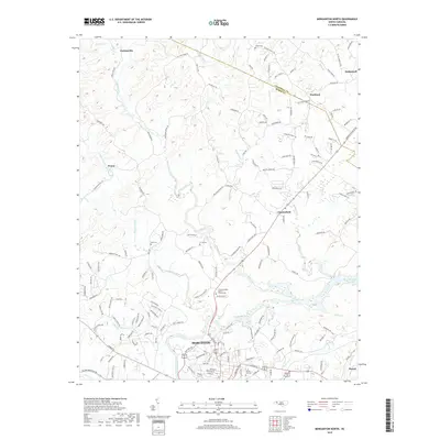
2019 Map of Morganton North
USGS Topo · Published 2019About this map
The Catawba River flows through the southern half of this landscape, marking the transition into the northern reaches of Morganton. This late-2010s survey shows a region defined by its numerous small creek drainages, including Upper Creek, Warrior Fork, and Bristol Cr, which all feed toward the river and the western edge of Rhodhiss Lake. The settlement pattern is largely dispersed, with small communities such as Hartland, Chesterfield, and Perkinsville connected by a network of rural roads like Old Oaks Farm Rd and Celia Creek Rd.
Find a feature on this map
153 named features on this map. Tap any name to fly to it.
Don’t see what you’re looking for? This feature index may not catch every label — zoom into the map to look around manually.
Map Details
Editions of this 2019 Morganton North Map
This is the sole edition of this map. No revisions or reprints were ever made.
Other maps of this area

1905 · Morganton
USGS Topo · 1:125,000

1953 · Charlotte
USGS Topo · 1:250,000

1954 · Charlotte
USGS Topo · 1:250,000

1956 · Valdese
USGS Topo · 1:24,000

1956 · Oak Hill
USGS Topo · 1:24,000

1956 · Collettsville
USGS Topo · 1:24,000

1956 · Morganton North
USGS Topo · 1:24,000

1956 · Morganton South
USGS Topo · 1:24,000

1956 · Lenoir
USGS Topo · 1:24,000
1956 · Chestnut Mtn.
USGS Topo · 1:24,000