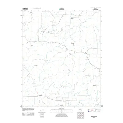
2011 Map of Morganton
USGS Topo · Published 2011About this map
North Fork Cadron Creek winds through a landscape of named ridges and creek bottoms in this early 21st-century survey of Van Buren County. The settlement patterns reflect a rural network anchored by small communities like Morganton, Gravesville, and Fairbanks. Topographic landmarks provide significant local orientation, with Batesville Mountain in the south and White Oak Mountain to the east framing the drainage basins of Scroggins Creek and Linn Creek.
Find a feature on this map
69 named features on this map. Tap any name to fly to it.
Don’t see what you’re looking for? This feature index may not catch every label — zoom into the map to look around manually.
Map Details
Editions of this 2011 Morganton Map
This is the sole edition of this map. No revisions or reprints were ever made.
Other maps of this area

1892 · Mountain View
USGS Topo · 1:125,000

1894 · Mountain View
USGS Topo · 1:125,000

1956 · Russellville
USGS Topo · 1:250,000

1961 · Bee Branch
USGS Topo · 1:62,500

1961 · Bee Branch
USGS Topo · 1:24,000

1961 · Morganton
USGS Topo · 1:24,000

1961 · Damascus
USGS Topo · 1:24,000

1961 · Guy
USGS Topo · 1:24,000

1963 · Quitman
USGS Topo · 1:24,000
1963 · Barney
USGS Topo · 1:24,000