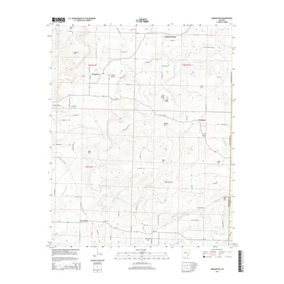
2014 Map of Morganton
USGS Topo · Published 2014About this map
Morganton and the surrounding highlands of Van Buren County are defined by a complex network of ridges and watercourses. The landscape is carved by the North Fork Cadron Creek and its many tributaries, including Linn Creek and Bee Branch. Small settlements like Sulphur Springs and Fairbanks are connected by winding routes such as State Highway 356, while family names are preserved on landmarks like Hunter Mountain, Pryor Mountain, and Odom Point.
Find a feature on this map
85 named features on this map. Tap any name to fly to it.
Don’t see what you’re looking for? This feature index may not catch every label — zoom into the map to look around manually.
Map Details
Editions of this 2014 Morganton Map
This is the sole edition of this map. No revisions or reprints were ever made.
Other maps of this area

1892 · Mountain View
USGS Topo · 1:125,000

1894 · Mountain View
USGS Topo · 1:125,000

1956 · Russellville
USGS Topo · 1:250,000

1961 · Bee Branch
USGS Topo · 1:62,500

1961 · Bee Branch
USGS Topo · 1:24,000

1961 · Morganton
USGS Topo · 1:24,000

1961 · Damascus
USGS Topo · 1:24,000

1961 · Guy
USGS Topo · 1:24,000

1963 · Quitman
USGS Topo · 1:24,000
1963 · Barney
USGS Topo · 1:24,000