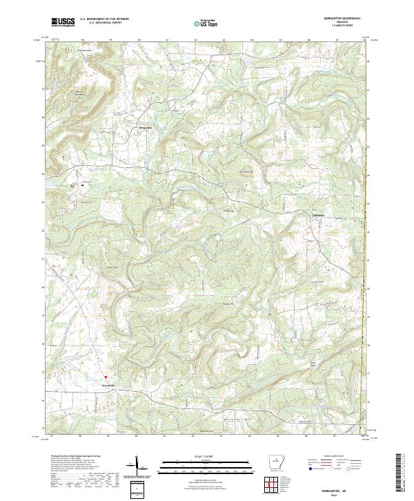
2024 Map of Morganton
USGS Topo · Published 2024About this map
Morganton sits at the northern end of this central Arkansas survey, where the landscape is defined by the winding course of the North Fork Cadron Creek. The terrain is marked by distinct ridges and peaks, including Rock House Hill and Phillips Hill, which shape the drainage patterns of small tributaries like Lint Creek and Scroggins Creek. To the south, the community of Gravesville anchors the local road network near the base of Batesville Mtn.
Find a feature on this map
84 named features on this map. Tap any name to fly to it.
Don’t see what you’re looking for? This feature index may not catch every label — zoom into the map to look around manually.
Map Details
Editions of this 2024 Morganton Map
This is the sole edition of this map. No revisions or reprints were ever made.
Other maps of this area

1892 · Mountain View
USGS Topo · 1:125,000

1894 · Mountain View
USGS Topo · 1:125,000

1956 · Russellville
USGS Topo · 1:250,000

1961 · Bee Branch
USGS Topo · 1:62,500

1961 · Bee Branch
USGS Topo · 1:24,000

1961 · Morganton
USGS Topo · 1:24,000

1961 · Damascus
USGS Topo · 1:24,000

1961 · Guy
USGS Topo · 1:24,000

1963 · Quitman
USGS Topo · 1:24,000
1963 · Barney
USGS Topo · 1:24,000