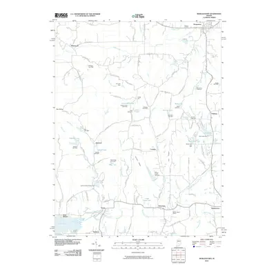
2010 Map of Morgantown
USGS Topo · Published 2010About this map
Morgantown sits at the northern edge of a landscape defined by its intricate drainage patterns and small-scale water management, where numerous dams such as Bardonner Lake Dam and Merriman Lake Dam dot the countryside. The southern portion of the area is anchored by the community of Beanblossom and the winding Beanblossom Creek, illustrating the rural development of Indiana in the early 21st century. Significant for local historians, the sheet records established sites like Williams Cemetery and the Lutheran Church Camp Dam, while the presence of the Kenstin Manor Airport and a network of named ridges like Carmel Ridge and Oak Ridge suggests a complex local geography. Settlement clusters at Helmsburg, Trevlac, and Mahalasville are connected by a mix of primary routes and older corridors like Old Railroad Rd, reflecting the region's enduring transportation history.
Find a feature on this map
120 named features on this map. Tap any name to fly to it.
Don’t see what you’re looking for? This feature index may not catch every label — zoom into the map to look around manually.
Map Details
Editions of this 2010 Morgantown Map
This is the sole edition of this map. No revisions or reprints were ever made.
Other maps of this area

1942 · Franklin
USGS Topo · 1:125,000

1946 · Belmont
USGS Topo · 1:24,000

1947 · Unionville
USGS Topo · 1:24,000

1947 · Nashville
USGS Topo · 1:24,000

1947 · Franklin
USGS Topo · 1:62,500

1948 · Trafalgar
USGS Topo · 1:24,000

1948 · Hindustan
USGS Topo · 1:24,000

1948 · Fruitdale
USGS Topo · 1:24,000

1948 · Morgantown
USGS Topo · 1:24,000

1949 · Nashville
USGS Topo · 1:24,000