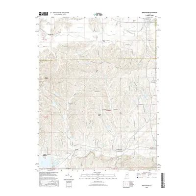
2016 Map of Morgantown
USGS Topo · Published 2016About this map
Morgantown and the surrounding borderlands of Morgan, Brown, and Johnson counties are detailed in this 2016 survey. The landscape is defined by the winding course of Indian Creek in the north and the many small reservoirs that dot the central hills, including Weaver Lake, Autumn Lake, and Shady Oaks Lake. This era shows a transition from traditional agricultural patterns to more recreation-focused land use, visible in the numerous lakes and the presence of camps like Waycross. In the south, the map traces the Beanblossom Creek valley through Helmsburg and Beanblossom, where the terrain begins to flatten near the northern edge of Lake Lemon at Point Idalawn. Notable high points like Cooks Hill and Bear Wallow rise above the drainage basins of Pike Cr and Lick Cr, while established local landmarks like Williams Cem and the rail-aligned community of Mahalasville provide grounding for family historians.
Find a feature on this map
133 named features on this map. Tap any name to fly to it.
Don’t see what you’re looking for? This feature index may not catch every label — zoom into the map to look around manually.
Map Details
Editions of this 2016 Morgantown Map
This is the sole edition of this map. No revisions or reprints were ever made.
Other maps of this area

1942 · Franklin
USGS Topo · 1:125,000

1946 · Belmont
USGS Topo · 1:24,000

1947 · Unionville
USGS Topo · 1:24,000

1947 · Nashville
USGS Topo · 1:24,000

1947 · Franklin
USGS Topo · 1:62,500

1948 · Trafalgar
USGS Topo · 1:24,000

1948 · Hindustan
USGS Topo · 1:24,000

1948 · Fruitdale
USGS Topo · 1:24,000

1948 · Morgantown
USGS Topo · 1:24,000

1949 · Nashville
USGS Topo · 1:24,000