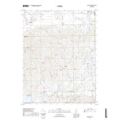
2019 Map of Morgantown
USGS Topo · Published 2019About this map
Morgantown stands at the northern edge of this landscape where Morgan, Brown, and Johnson Counties meet. The terrain transitions from the relatively flat agricultural lands near Sedwick Ditch and Indian Creek into the heavily wooded ridges and hollows characteristic of the southern Indiana highlands. This topography is defined by prominent landmarks like Cooks Hill, Carmel Ridge, and Oak Ridge, which separate numerous small watersheds. A high density of private and community water bodies is evident, ranging from larger recreational sites like Lake Lemon and Lake LaSalle to smaller tucked-away features such as Hungry Acres Lake and Linger Longer Lake.
Find a feature on this map
135 named features on this map. Tap any name to fly to it.
Don’t see what you’re looking for? This feature index may not catch every label — zoom into the map to look around manually.
Map Details
Editions of this 2019 Morgantown Map
This is the sole edition of this map. No revisions or reprints were ever made.
Other maps of this area

1942 · Franklin
USGS Topo · 1:125,000

1946 · Belmont
USGS Topo · 1:24,000

1947 · Unionville
USGS Topo · 1:24,000

1947 · Nashville
USGS Topo · 1:24,000

1947 · Franklin
USGS Topo · 1:62,500

1948 · Trafalgar
USGS Topo · 1:24,000

1948 · Hindustan
USGS Topo · 1:24,000

1948 · Fruitdale
USGS Topo · 1:24,000

1948 · Morgantown
USGS Topo · 1:24,000

1949 · Nashville
USGS Topo · 1:24,000