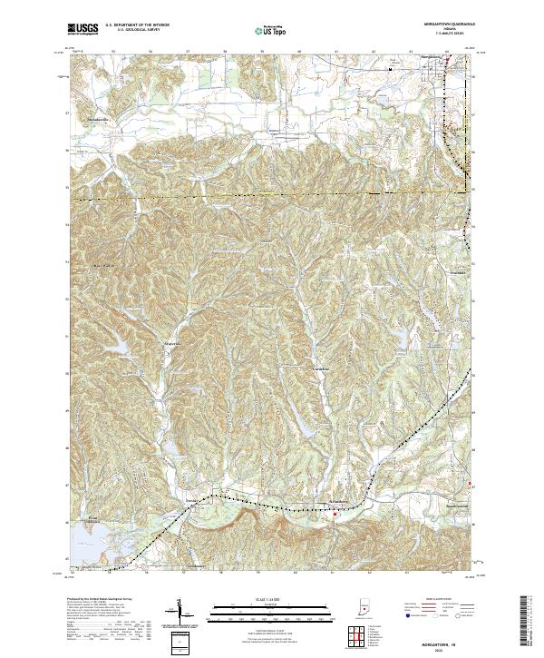
2022 Map of Morgantown
USGS Topo · Published 2022About this map
Morgantown and its surrounding hill country define this landscape at the intersection of Morgan, Brown, and Johnson counties. The terrain is deeply carved by water, with Indian Creek flowing through the northern reaches while Beanblossom Creek drains the southern valleys near the northern tip of Lake Lemon. The map reveals a dense network of upland ridges and narrow hollows, such as Oak Ridge and Carmel Ridge, which have influenced the layout of small settlements like Helmsburg, Beanblossom, and Trevlac.
Find a feature on this map
138 named features on this map. Tap any name to fly to it.
Don’t see what you’re looking for? This feature index may not catch every label — zoom into the map to look around manually.
Map Details
Editions of this 2022 Morgantown Map
This is the sole edition of this map. No revisions or reprints were ever made.
Other maps of this area

1942 · Franklin
USGS Topo · 1:125,000

1946 · Belmont
USGS Topo · 1:24,000

1947 · Unionville
USGS Topo · 1:24,000

1947 · Nashville
USGS Topo · 1:24,000

1947 · Franklin
USGS Topo · 1:62,500

1948 · Trafalgar
USGS Topo · 1:24,000

1948 · Hindustan
USGS Topo · 1:24,000

1948 · Fruitdale
USGS Topo · 1:24,000

1948 · Morgantown
USGS Topo · 1:24,000

1949 · Nashville
USGS Topo · 1:24,000