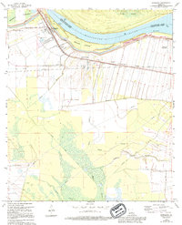
1968 Map of Morganza
USGS Topo · Published 1994About this map
The Mississippi River and its complex engineering dominate this landscape on the boundary of Pointe Coupee Parish. The massive Morganza Floodway and the Morganza Crevasse illustrate the ongoing effort to manage river overflows in this low-lying region. Along the river's edge, settlements like Morganza and Stonewall Plantation are connected by the Texas and Pacific railroad, which served the agricultural and industrial needs of the era. The map records several community landmarks, including Bright Morning Star Ch, Sixth Ward Ch, and the Labarre Sch, providing valuable points of reference for genealogists tracing family roots in these riverfront hamlets. To the south, a network of bayous including Bayou Barre and Bayou Portage weave through the terrain, punctuated by modern infrastructure like the Sewage Disposal Pond and various pipelines.
Find a feature on this map
33 named features on this map. Tap any name to fly to it.
Don’t see what you’re looking for? This feature index may not catch every label — zoom into the map to look around manually.
Map Details
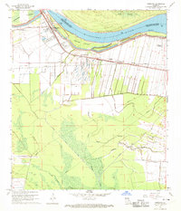
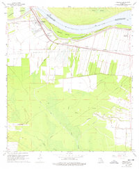
Editions of this 1968 Morganza Map
3 editions found
Other maps of this area

1906 · Bayou Sara
USGS Topo · 1:125,000

1939 · St. Francisville
USGS Topo · 1:62,500

1939 · Fordoche
USGS Topo · 1:62,500

1941 · Batchelor
USGS Topo · 1:62,500

1953 · New Roads
USGS Topo · 1:24,000

1954 · Fordoche
USGS Topo · 1:24,000

1954 · Erwinville
USGS Topo · 1:24,000

1954 · Baton Rouge
USGS Topo · 1:250,000

1955 · Fordoche
USGS Topo · 1:62,500

1955 · Batchelor
USGS Topo · 1:62,500