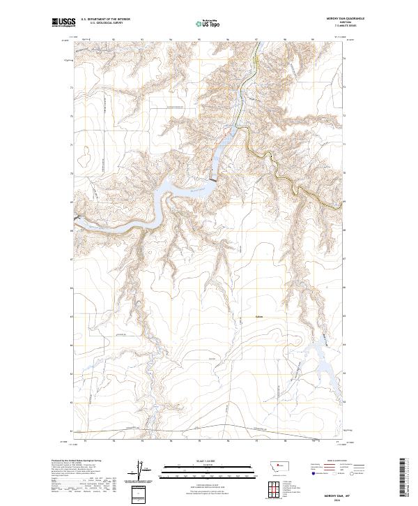
2024 Map of Morony Dam
USGS Topo · Published 2024About this map
Morony Dam anchors this landscape, where the Missouri River cuts deep through the high plains of northern Montana. The terrain is defined by a network of drainage features including Blackfeet Gulch, Portage Coulee, and Widow Coulee, reflecting the erosion patterns common to this reach of the river. The small settlement of Salem sits on the southern plateau, connected to the river valley by an established network of rural routes such as Salem Rd and Bickford Rd.
Find a feature on this map
30 named features on this map. Tap any name to fly to it.
Don’t see what you’re looking for? This feature index may not catch every label — zoom into the map to look around manually.
Map Details
Editions of this 2024 Morony Dam Map
This is the sole edition of this map. No revisions or reprints were ever made.
Other maps of this area

1886 · Great Falls
USGS Topo · 1:250,000

1890 · Fort Benton
USGS Topo · 1:250,000

1892 · Fort Benton
USGS Topo · 1:250,000

1897 · Fort Benton
USGS Topo · 1:250,000

1948 · Portage
USGS Topo · 1:62,500

1949 · Portage
USGS Topo · 1:62,500

1954 · Great Falls
USGS Topo · 1:250,000

1954 · Lander Crossing
USGS Topo · 1:24,000

1954 · Waltham
USGS Topo · 1:24,000

1955 · Stockett
USGS Topo · 1:62,500