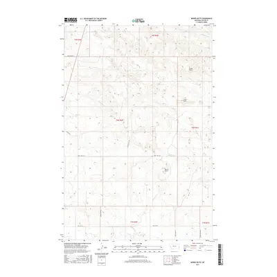
2017 Map of Morris Butte
USGS Topo · Published 2017About this map
Morris Butte and other distinct elevations like Cedar Butte define this portion of Fallon County, where the topography is shaped by a branching network of prairie waterways. This 2017 survey details a landscape where seasonal drainages such as Cannonball Cr, Cottonwood Cr, and Sandstone Cr intersect with a grid of rural access roads. The naming of routes like School House Rd and Fertile Prairie Rd reflects the agricultural foundations of the region, while Shell Oil Rd points to the area's industrial history and natural resource development. Researchers can trace the legacy of early land divisions and the movement of ranching or energy interests through the intricate trail systems, including Johny Creek Trl and Rolling Hills Trl, which navigate the draws and rises of the northern Great Plains.
Find a feature on this map
22 named features on this map. Tap any name to fly to it.
Don’t see what you’re looking for? This feature index may not catch every label — zoom into the map to look around manually.
Map Details
Editions of this 2017 Morris Butte Map
This is the sole edition of this map. No revisions or reprints were ever made.
Other maps of this area

1953 · Miles City
USGS Topo · 1:250,000

1957 · Miles City
USGS Topo · 1:250,000

1958 · Miles City
USGS Topo · 1:250,000

1981 · Baker
USGS Topo · 1:100,000

1981 · Baker NE
USGS Topo · 1:24,000

1981 · Buffalo Reservoir
USGS Topo · 1:24,000

1981 · Baker
USGS Topo · 1:24,000
1981 · Morris Butte
USGS Topo · 1:24,000
1981 · Badland Draw
USGS Topo · 1:24,000
1981 · Shell Butte
USGS Topo · 1:24,000