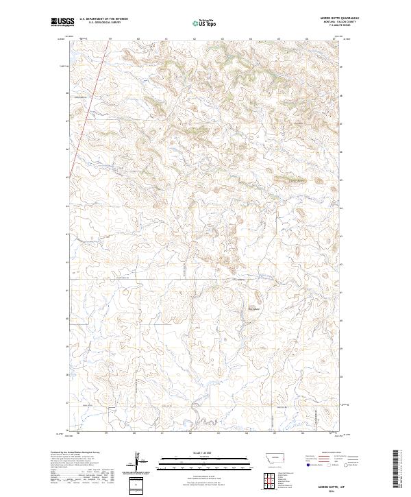
2024 Map of Morris Butte
USGS Topo · Published 2024About this map
Morris Butte stands as a prominent landmark in this section of Fallon County, part of a landscape defined by isolated peaks and seasonal watercourses. The drainage network is characterized by numerous creeks, including Cannonball Creek, Johny Creek, and Cottonwood Creek, which carve through the terrain. A network of rural routes and trails suggests a landscape dedicated to ranching and resource extraction, with names like School House Rd hinting at former community centers in this sparsely populated region. Evidence of industrial activity is present along the southern portion of the map, specifically near Shell Oil Rd. The topography is further marked by other distinct elevations such as Cedar Butte and Grassy Butte, while named paths like Johny Creek Trl and Rolling Hills Trl provide access through the undulating plains.
Find a feature on this map
22 named features on this map. Tap any name to fly to it.
Don’t see what you’re looking for? This feature index may not catch every label — zoom into the map to look around manually.
Map Details
Editions of this 2024 Morris Butte Map
This is the sole edition of this map. No revisions or reprints were ever made.
Other maps of this area

1953 · Miles City
USGS Topo · 1:250,000

1957 · Miles City
USGS Topo · 1:250,000

1958 · Miles City
USGS Topo · 1:250,000

1981 · Baker
USGS Topo · 1:100,000

1981 · Baker NE
USGS Topo · 1:24,000

1981 · Buffalo Reservoir
USGS Topo · 1:24,000

1981 · Baker
USGS Topo · 1:24,000
1981 · Morris Butte
USGS Topo · 1:24,000
1981 · Badland Draw
USGS Topo · 1:24,000
1981 · Shell Butte
USGS Topo · 1:24,000